Explore Fallout Zones and Affected Regions
Radioactive fallout from nuclear testing spread far beyond test sites. Explore maps that reveal where exposure was highest — and find out if your community was affected.
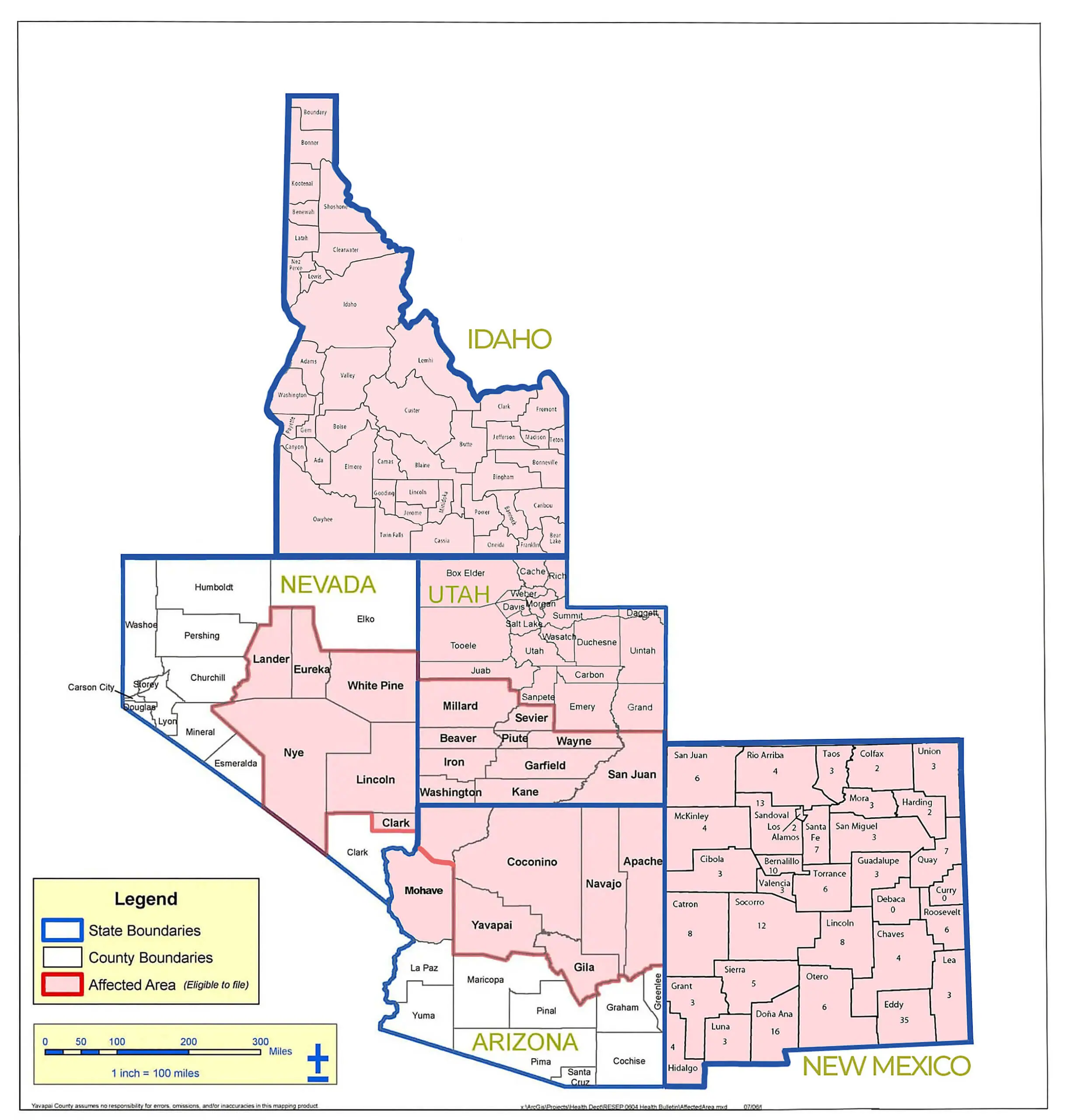
Fallout Spread Across the Decades
From the 1950s to the 1970s, radioactive clouds traveled across multiple states — far beyond the Nevada Test Site.
Why These Maps Matter

Many residents in downwind areas never knew they were exposed to radiation. Decades later, countless families continue to experience health effects linked to nuclear testing. Understanding where fallout spread helps bring awareness, accountability, and healing to impacted communities.
These maps turn abstract data into human stories. Each shaded area represents real people—farmers, teachers, children—whose lives were quietly shaped by invisible forces. By visualizing the reach of radioactive fallout, we can better grasp the scale of its impact and the urgent need to document and learn from it.
They also serve as powerful tools for justice and remembrance. Communities that were once ignored can now trace their connection to history’s hidden costs.
Do You Live in an Affected Area?
If your county or community appears in these maps, you may qualify for compensation under RECA. Take a moment to verify your eligibility.
FOLLOW US
COMPANY
CUSTOMER CARE
LEGAL
Copyright 2026. Downwinders Alliance. All Rights Reserved.